Be weather aware as we head through the rest of this week.
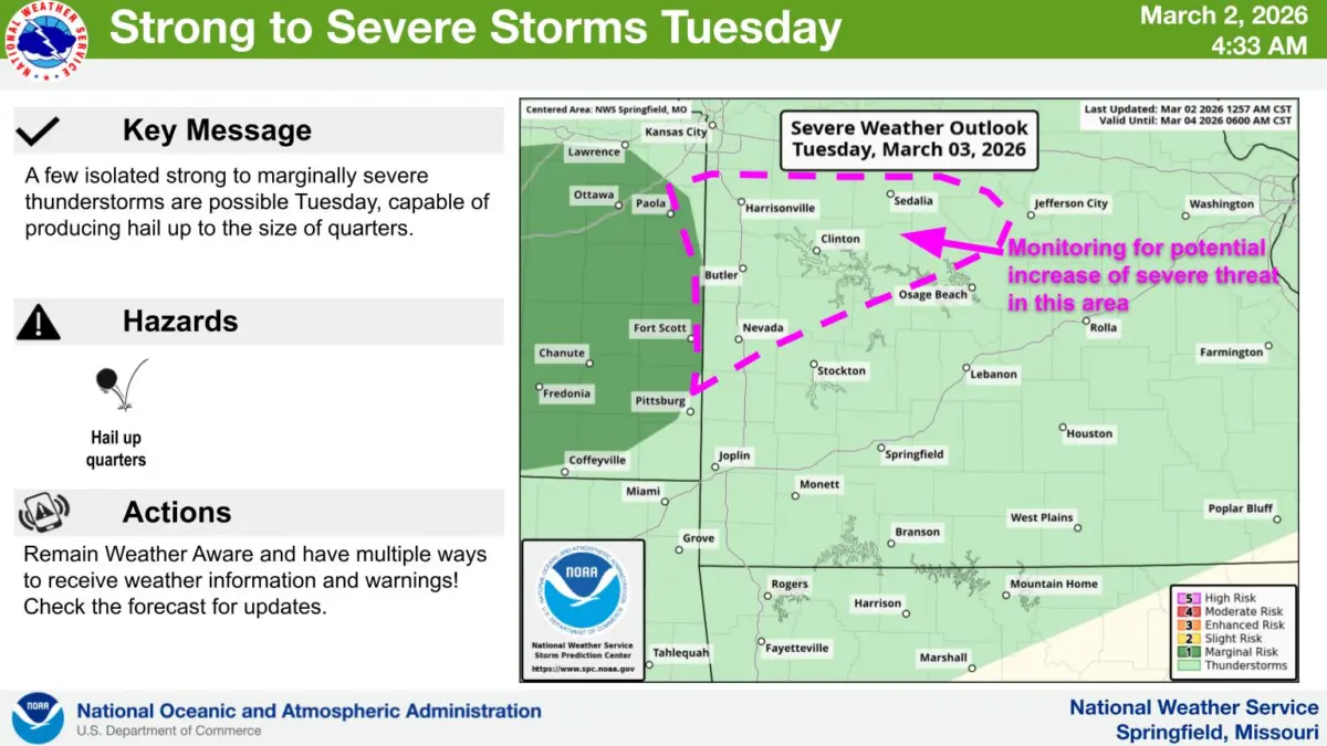
The National Weather Service says rounds of strong to severe storms are possible across parts of the Ozarks Tuesday and Tuesday night, mainly north of I-44.
Hail up to the size of quarters is possible.
Storms are then expected to fire Wednesday along a cold front, capable of producing 60 mile per hour winds and quarter size hail, locally heavy rain and flooding,
There is a minimal tornado threat.
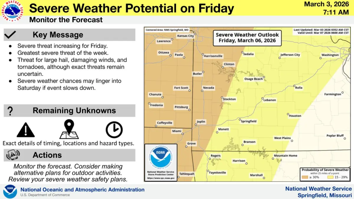
Then, all modes of severe weather are possible on Friday, including tornadoes.
In addition, because thunderstorms are in the forecast for Wednesday, the National Weather Service office in Springfield, which covers all of southwest Missouri, says it will not be participating in the annual tornado drill.
The Weather Service says other areas of the state may continue with the drill at 10am Wednesday.