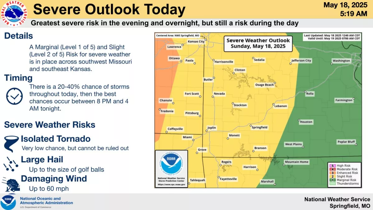
After a quiet Saturday, with some non severe thunderstorms rolling through the Ozarks late Saturday night, stay weather aware for both Sunday and Monday.
The National Weather Service says showers and thunderstorms may develop and lift north along a warm front through the course of Sunday.
These have a low (5-15%) chance of becoming severe.
Later Sunday evening into the nighttime hours, storms moving in from Kansas and Oklahoma will present a greater severe risk.
However, details on exact storm mode and locations are still uncertain.
Strong to severe thunderstorms are possible again Monday and Monday night, and as with Sunday, forecasters say the greater severe risk exists during the evening and overnight hours.
But the weather service cannot rule out severe storms during the day Monday.
A moderate (level 4 of 5) risk may be issued for portions of the area in future updates, but most of the state is currently under a level 3 enhanced risk for severe weather on Monday.
Hazards will depend on storm mode and evolution, with increasing confidence in a line of storms Monday night.
We’ll have all the watches and warnings and storm updates on 93-3 and A-M 560 KWTO.