An active stretch of weather in the Ozarks will begin Thursday and last into early next week.
The National Weather Service says there is a slight chance for thunderstorms in the eastern Ozarks and south central Missouri Thursday afternoon and evening.
If storms do form, they could produce very large hail up to the size of tennis balls.
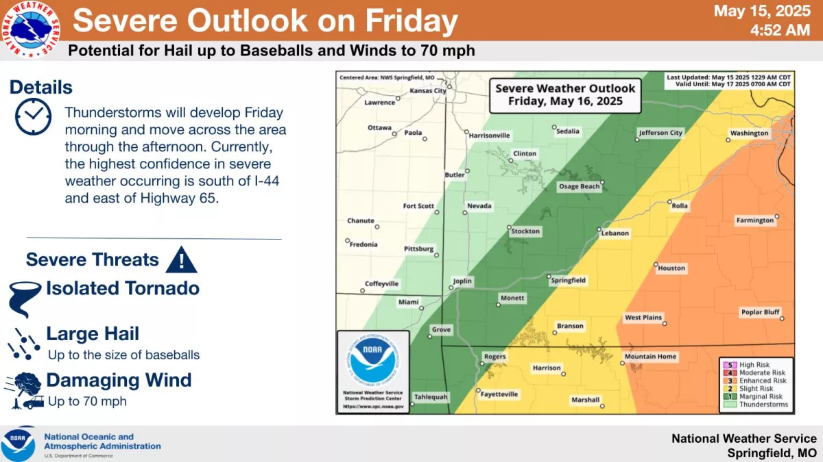
Storms will develop again Friday morning and move across the Ozarks from west to east through the afternoon.
Currently, the best chances of severe weather are south of I-44 and east of Highway 65.
Hail up to the size of baseballs, damaging winds up to 70 miles per hour and an isolated tornado are also possible.
We’ll keep you up to date with the latest forecast changes, plus any watches and warnings on 93-3 and A-M 560 KWTO.