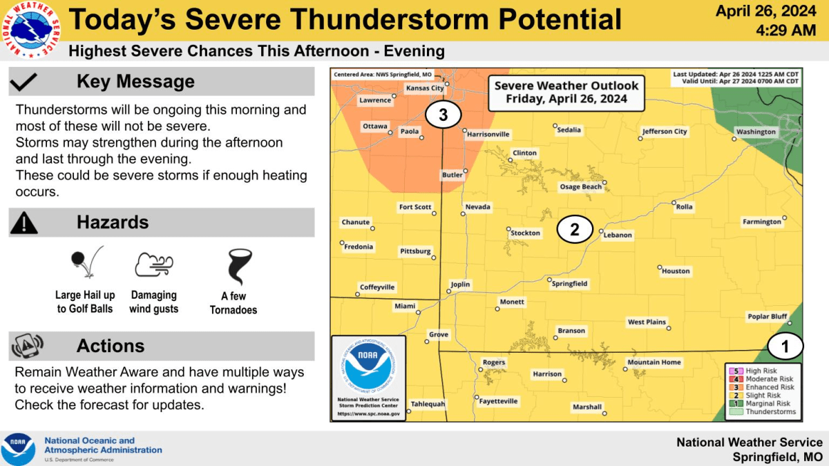
Thunderstorms have been ongoing across the Ozarks Friday morning, with heavy rain, flooding and more road closures.
The National Weather Service says rainfall amounts are not expected to be as heavy as Thursday, which saw upwards of 6- 7 inches in Jasper County.
On Friday, rainfall amounts of 1/2 inch to 1 inch will be common, with localized amounts up to two inches in locations that experience repeated storms.
Thunderstorms may strengthen Friday afternoon, and if enough heating occurs, those storms could produce large hail up to the size of golf balls, damaging wind gusts, and tornadoes.
But forecasters say confidence is low as to how this will evolve.
After a mostly dry day Saturday, severe thunderstorms will move into southeast Kansas and western Missouri Saturday evening into the overnight hours.
The most significant severe weather potential exists eastern Kansas and areas north of a Nevada to Clinton line.
This will largely be an overnight severe weather and flooding threat into early Sunday morning.
The weather service says severe thunderstorms could be ongoing Sunday morning, with additional storms in the afternoon.
The entire area is under a level 2 “slight risk” for severe thunderstorms on Sunday.
We’ll keep you and your family up to date with the latest weather forecasts, as well as any watches, warnings, and storm damage reports on 93-3 and A-M 560 KWTO.
