The National Weather Service says the first of two rounds of the winter storm is trending towards the low end of forecast amounts of 1-3 inches.
Amounts on Saturday morning have been light in the Springfield area, with a dusting on the ground.
Parts of extreme southwest Missouri have had more snow, with 2.25 inches measured by 8am southwest of Goodman in McDonald County.
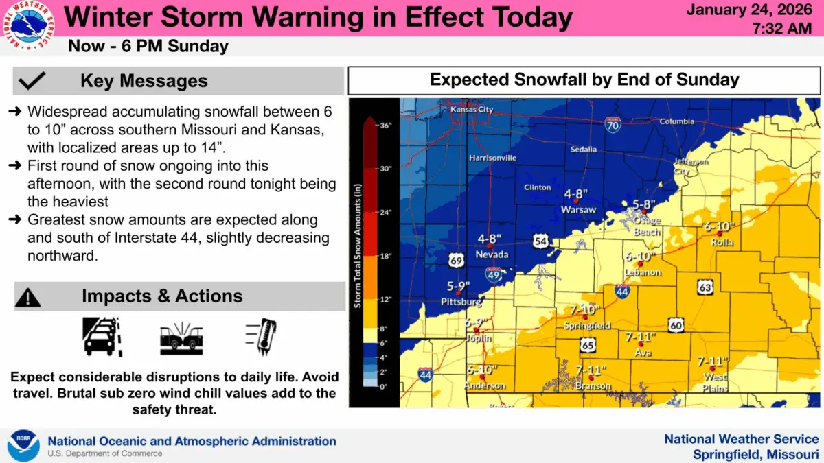
The National Weather Service is stressing the second round of snow, which begins Saturday night, will be the heaviest. That snow will be ongoing through Sunday afternoon.
The Winter Storm Warning continues through 6pm Sunday, with widespread total accumulations between 6 to 10 inches across southern Missouri.
Forecasters say the greatest snow amounts are expected along and south of I-44, with totals slightly decreasing northward.
The weather service says expect considerable disruptions to daily life, with travel conditions becoming hazardous.
Brutal sub zero wind chills will add to the safety threat.
Powdery snow blowing across roads will make for slick travel conditions Saturday, but meteorologists say don’t let your guard down because the “big event’ is still on the way.
There is expected to be a lull between the first and second rounds of the winter storm in the Springfield area and much of southwest Missouri.
NWS put together a timing of snowfall graphic that shows the first round of snow ending by 3pm Saturday in the Springfield area, then picking up again around 9pm with light snow.
Heavy snow is then expected between midnight and 8am Sunday in the Springfield, Branson, Joplin, Camdenton, West Plains and Rolla areas, with moderate snow falling between 8am and noon and down to light snow Sunday afternoon.