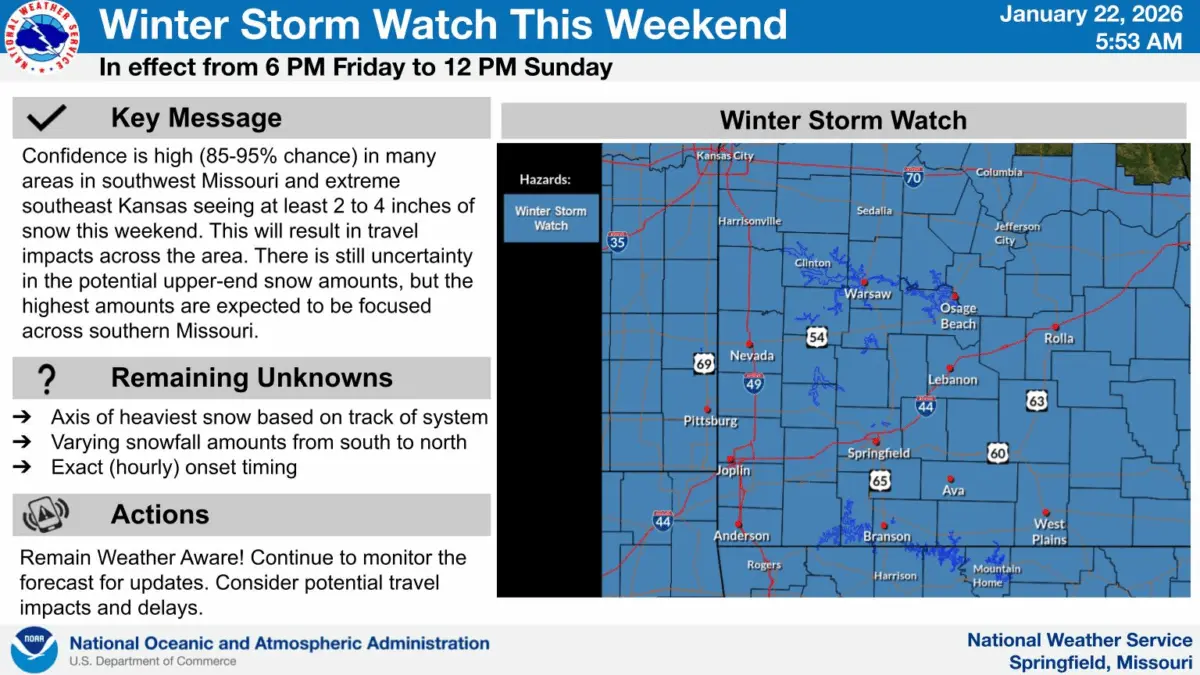
A Winter Storm Watch is in effect for all of the Ozarks starting at 6pm Friday and going through Noon on Sunday.
The National Weather Service says a large winter storm will track through the area, bringing impactful, accumulating snow through Sunday.
Dangerous cold will accompany this system, bringing single digit lows and below zero wind chills through at least next Tuesday.
The weather service says 3-8 inches of snow are possible, with the lower amounts toward central Missouri.
High end amounts could approach 9 to 10 inches across far southern Missouri from Anderson to Branson to West Plains.
6 to 7 inches of snow are currently forecast for the Springfield area, but changes to the forecast remain possible.
Forecasters say moderate impacts are expected for much of southwest Missouri. Expect disruptions to daily life with hazardous driving conditions. Closures and disruptions to infrastructure may occur.
We’ll keep you up to date with the latest forecast and changes to snow totals on 93-3 and AM 560 KWTO.