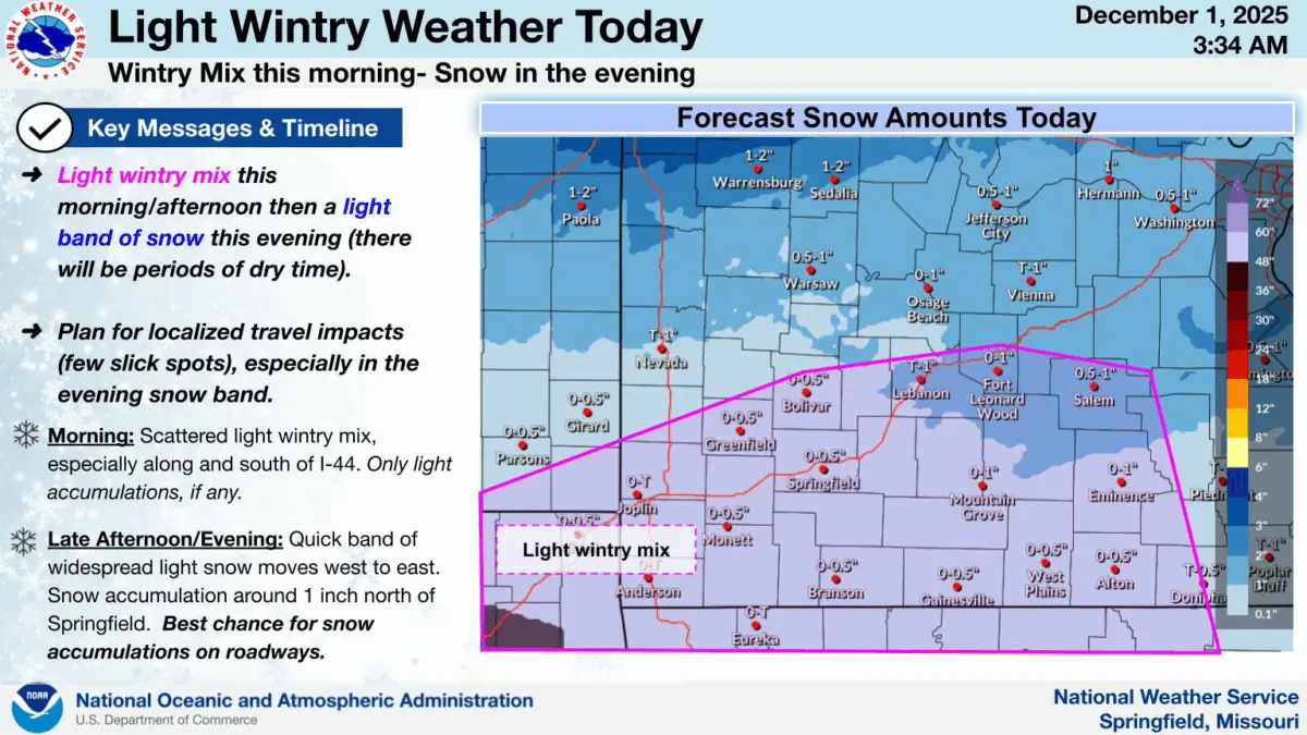
A quick moving system will push through the Ozarks on this first day of December, bringing light snow showers, along with the potential for light sleet and/or freezing rain along and south of I-44.
The National Weather Service says plan for localized travel impacts in the form of a few slick spots, especially with a band of snow moving from west to east across the area Monday evening.
A light wintry mix is possible Monday morning and afternoon, with a light band of snow in the evening. There will be periods of dry time.
A half inch of snow or less is possible across much of the Ozarks, with around one inch possible in the northern Ozarks.
We’ll keep you up to date with the latest changing forecast on 93-3 and AM 560 KWTO.