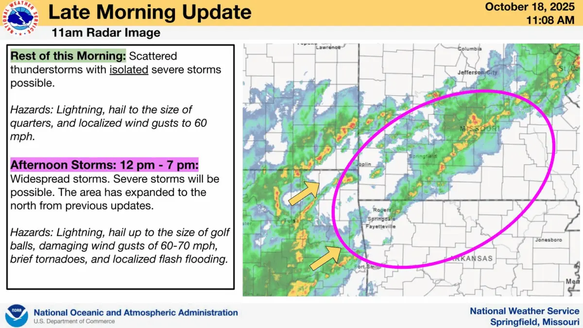
Saturday 11:20AM Update: All modes of severe weather will be possible in the Ozarks on Saturday afternoon into the evening hours.
A Severe Thunderstorm Watch has been issued by the National Weather Service for all of southwest Missouri until 6:00pm Saturday.
Hazards with Saturday afternoon’s storms include hail up to the size of golf balls, damaging wind gusts of 60 to 70 miles per hour, brief tornadoes and localized flash flooding.
Original Story: The National Weather Service says scattered showers and storms will move into western Missouri late Friday night, and some of those could be strong to severe around the I-49 corridor and the northwestern Ozarks.
Storms will become more widespread south of I-44 by Saturday afternoon.
A few of those storms may be strong to severe, with the greatest risk along and south of I-44 during the late morning and early afternoon hours.
We’ll keep you up to date with any watches and warnings on 93-3 and AM 560 KWTO.