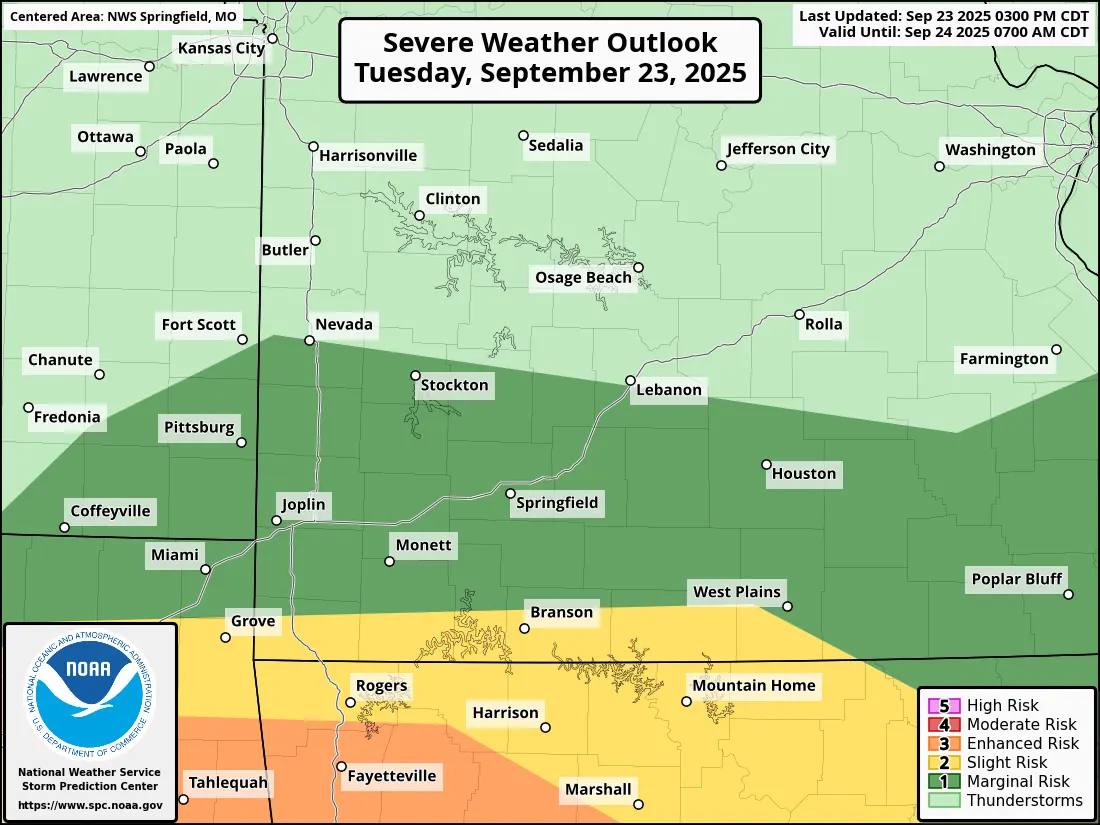
UPDATE: 3:30pm Tuesday: The National Weather Service has moved the severe weather risk closer to the Missouri/Arkansas border for the rest of Tuesday afternoon and evening.
Here’s what the NWS is saying about storm development: An Enhanced has been added south of the Arkansas border and all of the hazards have been pulled farther south out of our area, decreasing our risks slightly, but we are still expecting to see the most severe activity along the MO/AR border.
Original Story: Widespread rain and thunderstorms are expected in the Ozarks Tuesday.
The National Weather Service says areas along and south of a line from Joplin to West Plains are under a Level 2 “Slight Risk” for severe weather, This is for a risk of tornadoes, damaging wind gusts of 60-70 mph, and up to golf ball-sized hail.
A Flood Watch is in effect through Tuesday night for areas south of I-44, with rainfall amounts between 1 and 3 inches possible.
We’ll keep you up to date with any watches and warnings on 93-3 and A-M 560 KWTO.