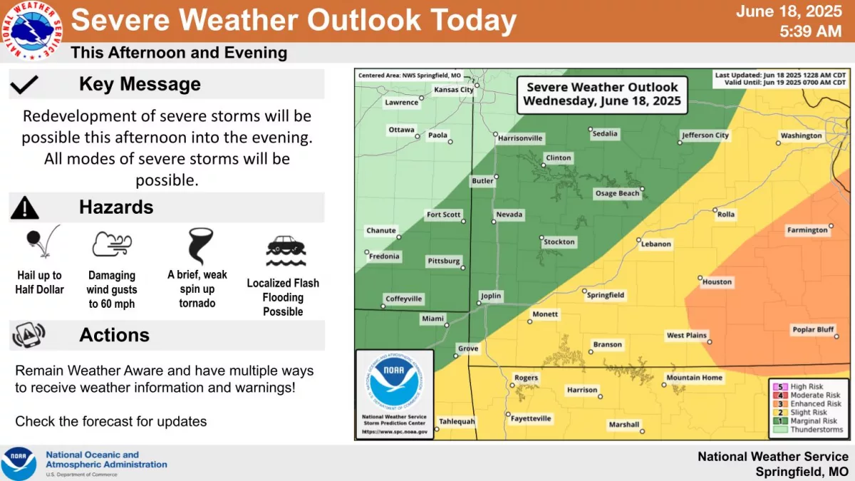
After a few severe storms moved through far southwest Missouri overnight, a second round of severe weather is possible Wednesday afternoon and evening.
The National Weather Service says the highest potential for bad weather is in the far eastern Ozarks, east of a line from West Plains to Houston.
A Level 3 “enhanced risk” is in place for this area.
Damaging winds up to 60 to 70 miles per hour, large hail up to the size of half dollars, and a very conditional threat for short, weak spin-up tornadoes.
Areas along and south of I-44 are under a Level 2 “slight risk” for severe storms, with communities north of the interstate looking at a Level 1 “marginal risk.”
Listen for severe weather updates on 93-3 and AM 560 KWTO.