We have flooding concerns this Memorial Day weekend in the Ozarks.
The National Weather Service says the first of several rounds of rain will begin Friday evening.
Soils are already saturated from recent rains and stream levels are already elevated.
A Flood Watch is in effect for all of southwest Missouri from Friday evening through Monday evening.
The National Weather Service says 4 to 6 inches of rain could fall in Springfield, with 6 to 8 inches in Joplin and Branson.
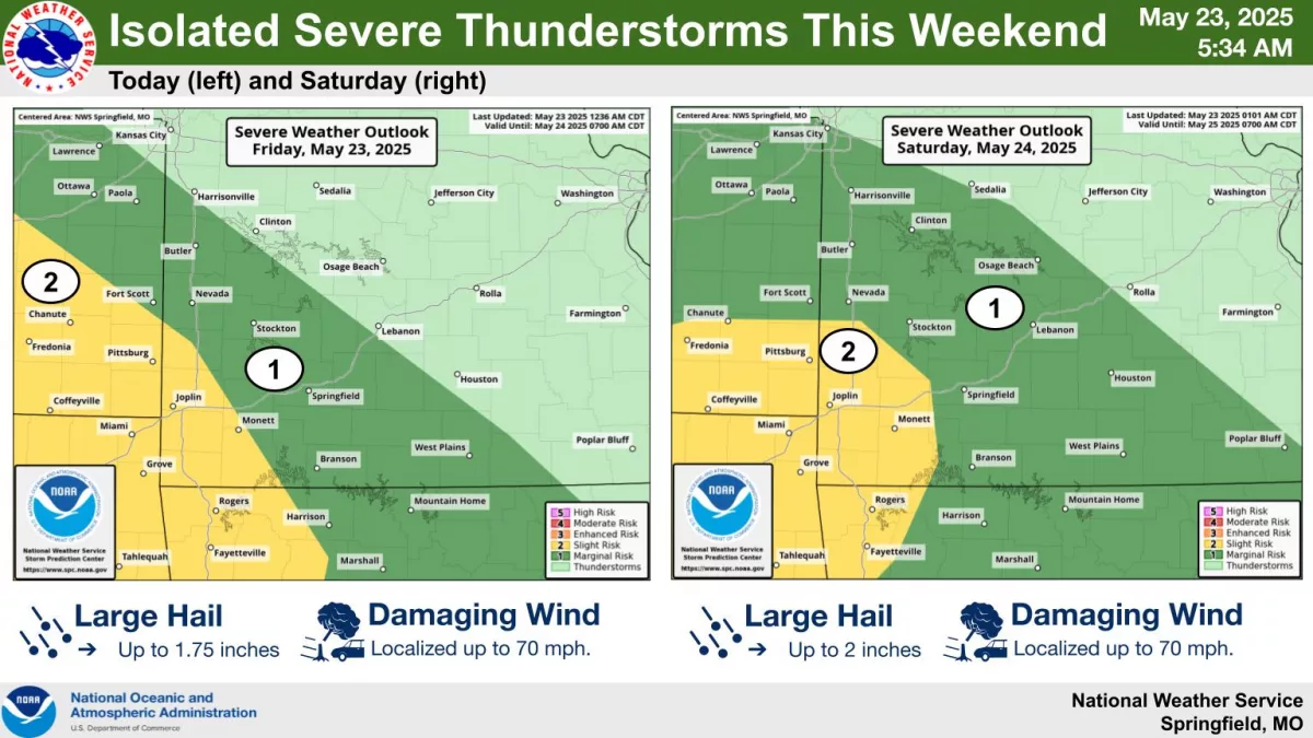
In addition, storms in the Ozarks could be severe Friday evening and again Saturday evening.
Forecasters say hail up to the size of golf balls and damaging winds of 60 to 70 miles per hour will be the biggest threats from 6pm Friday through the late night hours.
Areas southwest of Springfield are under a Level 2 “slight risk” for severe storms.
On Saturday night, storms should begin after 8pm, with an isolated tornado threat, along with golf ball to possibly tennis ball size hail and 60 to 70 mile per hour winds, especially southwest of Springfield.
There’s a “marginal risk” of severe weather on Sunday.
Listen to 93-3 and AM 560 KWTO for the latest weather updates.