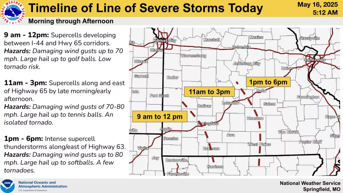
Large hail up to the size of baseballs, along with a chance of wind gusts up to 70 miles per hour and an isolated tornado: Much of the Ozarks is under at least some threat for severe weather on Friday.
The National Weather Service says scattered thunderstorms that are expected to develop Friday morning will move quickly from west to east between 10am and 3pm.
Additional storms are expected over the eastern Ozarks later in the day.
Areas east of Springfield are under a Level 3 “enhanced risk” for severe weather, with the far eastern Ozarks and southeast Missouri under a rare Level 4 “moderate risk.”
In the moderate risk area, hail up to softball size, wind gusts up to 80 miles per hour and a few tornadoes are all possible.
Additional strong to severe thunderstorms are possible at times through the weekend all the way through Tuesday of next week.
We’ll keep you up to date with watches, warnings and storm reports on 93-3 and A-M 560 KWTO.