Following a round of severe storms late Friday night that prompted both Tornado Warnings and Severe Thunderstorm Warnings in the Ozarks, more severe weather is on the way this Easter weekend.
The National Weather Service says the severe thunderstorm threat will ramp up again Saturday evening and overnight Sunday morning, with quarter size hail and damaging wind gusts being the primary threat, especially along and south of I-44.
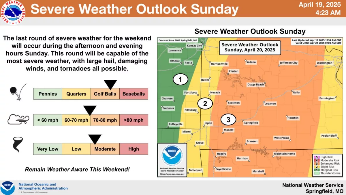
The final round of severe weather this weekend, on Easter Sunday, is shaping up to be the most intense, with large hail up to golf ball size, damaging winds, and tornadoes all possible.
Timing is expected to be during the afternoon and evening hours on Sunday between noon and 8pm.
Most of the Ozarks is now under a Level 3 “Enhanced Risk” for severe weather on Sunday, with the exception of our far western counties along the Interstate 49 corridor, which are in a Level 2 “Slight Risk” area.
We’ll keep you up to date with all the watches and warnings and any damage reports on 93-3 and A-M 560 KWTO.