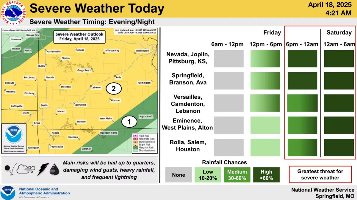
Strong to severe thunderstorms are expected to move into the Ozarks by Friday night into Saturday morning, with additional chances for severe storms and flooding through the Easter weekend.
The National Weather Service says there is a Level 2 “Slight Risk” for severe storms Friday evening through Sunday, with the highest chances Friday evening into Saturday, with large hail and damaging winds the main threats.
Those storms are expected to develop across southeast Kansas and western Missouri after 5pm and continue through the overnight hours.
The most likely severe threats are large hail up to the size of quarters and damaging winds of 60 to 70 miles per hour.
In addition, several rounds of heavy rainfall will lead to some flash flooding and rises on area rivers this weekend.
A Flood Watch is in effect from 7pm Friday through 7pm Sunday for all of southwest Missouri.
Total rainfall amounts of 2 to 5 inches are likely across the entire area through the holiday weekend, with localized amounts up to 7 inches.
We’ll keep you up to date with the watches and warnings and any reports of damage on 93-3 and A-M 560 KWTO.