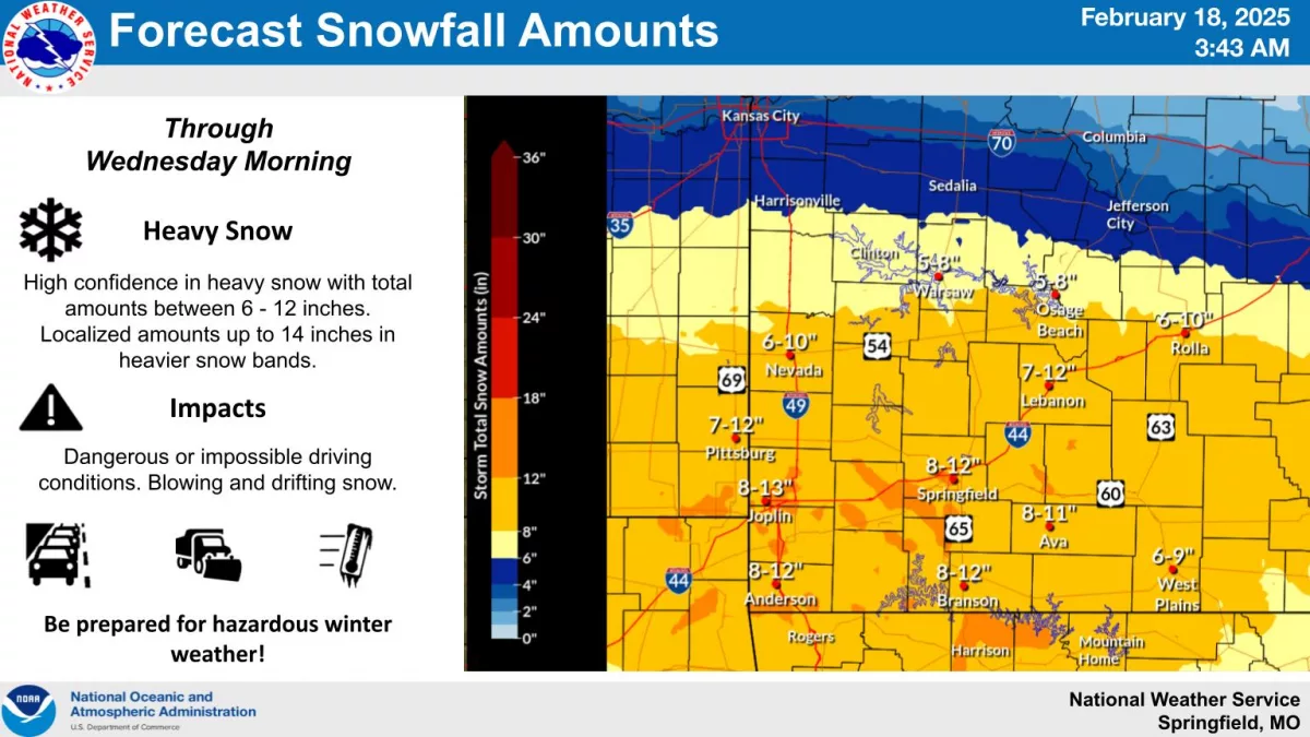
Heavy snow is expected in the Ozarks from late Tuesday morning through the afternoon and evening hours before winding down early Wednesday morning.
The National Weather Service says 8 to 12 inches of snow are possible in the Springfield, Branson and Joplin areas, with lesser amounts of 5 to 8 inches in the far northern Ozarks around Clinton, Warsaw and Osage Beach.
As of 7:15am, the MoDOT Traveler Information map was already showing snow covered roads north of Springfield along Highway 13 and Highway 65, west of Springfield along I-44 and I-49 and northeast of Springfield on I-44.
Forecasters say major impacts are anticipated across much of southwest Missouri, with considerable disruptions to daily life or even impossible driving conditions by Tuesday evening through the nighttime hours.
Blowing and drifting of snow will also create dangerous impacts for travelers.
A Cold Weather Advisory is in effect from 6pm Tuesday through 12pm Thursday, with a high confidence in dangerous cold through Friday morning. Wind chills of -10 to -20 are likely during this period.
By 6:35am Tuesday, we had reports of 1 inch of snow in the Stockton area, with city streets and secondary highways in the Lebanon area snow covered.
by 7:15am, roads were partially covered between Joplin and Neosho, and Highway 5 north of Lebanon was becoming snow-covered by 6am.