Snow, sleet, rain and freezing rain are all in play for your Wednesday as wintry weather moves through the Ozarks.
Snow entered the western Ozarks between 5:00 and 6:00am Wednesday, with reports of thunder snow northeast of Neosho and in the Joplin area.
By 6:30am, snow began to accumulate at the National Weather Service office in northwest Springfield.
By 7:00am, we had reports of a sleet and snow mix making roads slick in Taney County around Forsyth.
By that same time, most highways along and west of Highway 65 had become snow covered.
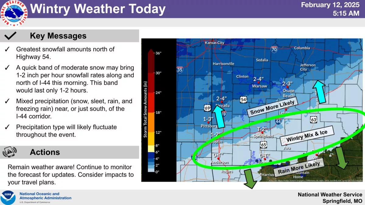
A Winter Weather Advisory is in effect for all of southwest Missouri until 9:00pm Wednesday, with areas north of the Ozarks north of a line from Harrisonville to Clinton, Sedalia and Columbia under a Winter Storm Warning for accumulating snow.
A quick band of moderate snow is moving along and north of the I-44 corridor Wednesday morning.
The greatest snowfall amounts are expected north of Highway 54, where 2-4 inches are expected, with a trace to 2 inches in the Springfield area.
For areas of far southern Missouri, a quick round of freezing rain will quickly transition to rain, limiting impacts to just as the freezing rain is falling.
Only a trace amount of snow is expected in an area from Anderson to Branson up to Ava.
Mixed precipitation (snow, sleet, rain, and freezing rain) is expected south of the I-44 corridor.
The good news is any ice accumulations are expected to be minor, with most areas receiving less than a tenth of an inch.
Overall, this is a quick-hitting storm, with the snow spreading east to the Highway 63 corridor in south central Missouri by 9am.
The snow will taper off from west to east by late Wednesday morning.
We’ll have the latest forecast and weather information on 93-3 and A-M 560 KWTO.