Round 1 of our wintry weather is winding down across the Ozarks Tuesday morning and pushing east quickly .
The National Weather Service says for most of us, the temps have been near or above freezing, but a few slick spots are possible, especially in the eastern Ozarks, along Highway 60.
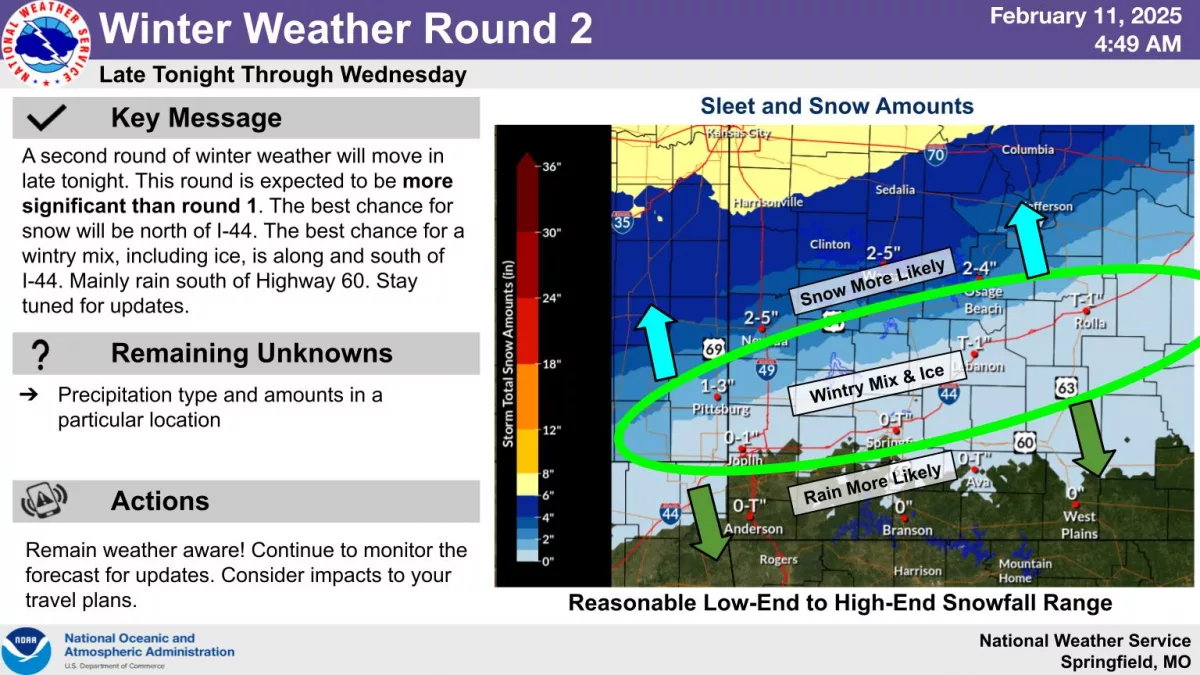
We could have a thin band of light snow Tuesday afternoon, then another Winter Weather Advisory goes into effect from midnight Tuesday night until 9pm Wednesday for a stronger system with mixed wintry precipitation.
At least minor travel impacts are expected Wednesday.
There’s a greater threat for freezing rain or sleet along the I-44 corridor on Wednesday, with anywhere from a glaze to 2/10ths of an inch of ice.
The greatest snow threat is in the northern Ozarks, with two to four inches of snow possible along and north of Highway 54.
A Winter Storm Warning is in effect through 9pm Wednesday for areas along and north of a line from Harrisonville to Clinton and Sedalia.
Heavy mixed precipitation is expected in the warned area, with total snow accumulations between 4 and 8 inches and a light glaze of ice.
This extends north to the Kansas City area, and hazardous driving conditions could impact the Wednesday morning and evening commute.