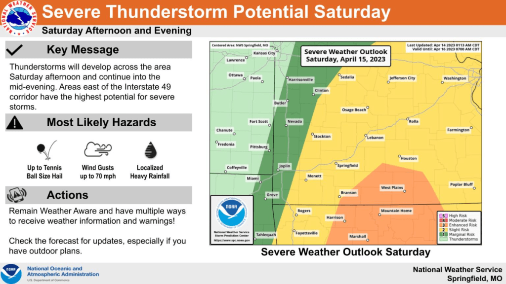
While the weather should be calm to start your weekend, there’s a growing risk for severe thunderstorms arriving mid-afternoon Saturday and continuing into the evening.
The National Weather Service says large hail up to the size of tennis balls, damaging winds up to 70 miles per hour, and an isolated tornado are possible.
Areas along the Interstate 49 corridor are under a “marginal,” or Level 1 risk, with Springfield and areas along and west of Highway 65 under a Level 2, or “slight” risk. The greatest threat for severe storms, an “enhanced” Level 3 risk, exists along and east of a line from Branson to Mountain Grove.
Forecasters say brief, localized heavy rainfall will also be possible Saturday, but widespread flooding is not expected.
Listen to 93-3 A-M 560 KWTO for the latest watches and warnings, and any hail, wind, or damage reports that come in from area spotters.