4:30 p.m. UPDATE: A strong thunderstorm will impact portions of south central Polk, northwestern Greene and southeastern Dade Counties through 5:00 p.m. The National Weather Service says doppler radar was tracking a strong thunderstorm near Ash Grove, moving northeast at 50 miles per hour. Wind gusts up to 50 miles per hour and half inch hail are possible in the Willard, Walnut Grove, Morrisville, Ash Grove, Pleasant Hope and Brighton areas. The weather service says this storm is showing signs of weakening some and is moving into a more stable air mass, so the weaking trend is likely to continue.
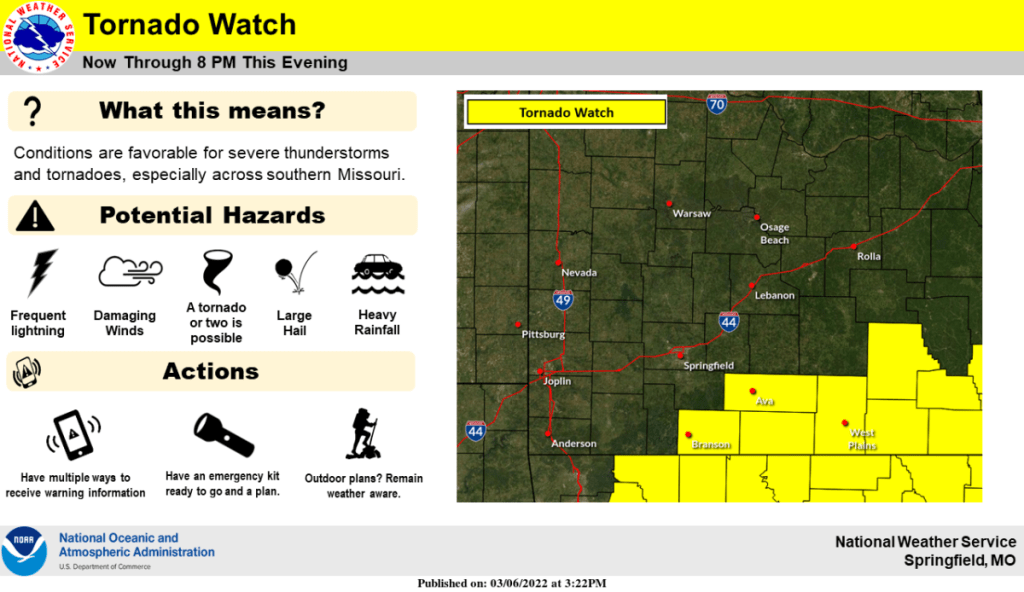
The Storm Prediction Center has issued a Tornado Watch until 8 p.m. Sunday for Taney, Ozark, Douglas and Howell Counties in the southern Ozarks extending into south central Missouri.
Scattered to numerous showers and thunderstorms have expanded into southern Missouri Sunday afternoon.
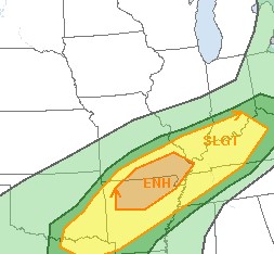
Strong to severe storms will be possible, mainly during the 5 p.m. to midnight time frame, primarily south of Interstate 44.
Damaging wind gusts to 70 miles per hour, hail to the size of quarters and a tornado or two are the primary threats.
A front will continue to move north of locations generally along and southeast of a Branson to Eminence line late Sunday afternoon into the evening.
Instability will increase south of this line and low level shear will increase early Sunday evening.
Storms will continue to develop and move northeast across the area.
The biggest severe weather risk will be along and south of that Branson to Eminence line between 4 and 9 p.m.
Again, all modes of severe weather are possible in these areas.
We’ll keep you up to date with any warnings with live updates on 93.3 A-M 560 KWTO.


