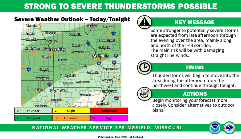
Some stronger storms will be possible late Thursday afternoon and evening, mainly along and north of the Interstate 44 corridor.
The National Weather Service says the main severe weather risk will be damaging straight line winds up to 60 miles per hour.
The Storm Prediction Center has an area from Joplin from Walnut Grove to Lebanon under a “marginal risk” for severe weather.
Heavy rain and flash flooding will be possible late Thursday through Friday morning to the west of Springfield along Interstate 49, where a Flash Flood Watch is in effect.
One to three inches of rain will be possible in those areas, with some training of storms across the same locations.